10 Epic Views in Norway You Have to Hike to Get To

It’s no big secret that Norwegians love to hike. But can you blame them? Norway is practically made for hiking: all these fjords, craggy cliffs and luscious valleys are best experienced from an altitude – with the help of your trusted pair of sneakers and a fully charged camera. If you’re wondering where to start though, we’ve gathered the top 10 places you need to hike to if you want to get the full picture (pun intended).
Aurlandsdalen
Aurlandsdalen is called ‘Norway’s Grand Canyon’ and it won’t take you long to understand why. Located at the end of the Sognefjord, this classic hiking destination has a bit of everything: rich nature, breathtaking views of the fjords (one of them, Nærøyfjord, is actually a UNESCO World Heritage Site) and rivers. Plus, it’s near the Jostedalsbreen National Park, if you fancy a glacier walk.

Kvalvika beach

Reinebringen
This is another amazing vantage point on the Lofoten Islands. Getting to the peak of Reinebringen and back will take you about two to three hours (start from just outside the village of Reine), but the view from the top will more than make up for it, as you’ll have the Arctic Sea, the fjords Reinefjorden and Kjerkfjorden and, of course, the majestic Lofoten Wall (Lofotveggen, in Norwegian) spread out in front of you.

Skåla
Mount Skåla, a mountain in the Jostedalsbreen National Park, is the highest mountain with its foot in a fjord – so basically, not only is the view from the top unparalleled, the walk up there isn’t too shabby either. Make sure to allot five hours for the ascent, and probably another five to gawk at the glacier and the fjord. There’s also a cute hut at the top, where you can spend the night or just have a cuppa.
Jotunheimen National Park
Jotunheimen National Park is not called the ‘home of the giants’ for nothing. With over 250 mountains almost 2000 metres high and 60 glaciers, here you can ski, hike, bike, climb, listen to waterfalls, spend the night in one of the park’s wooden huts and cabins and, of course, take amazing photos. Just pick a spot, any spot.

Gaustatoppen Mountain
From the top of Gaustatoppen, at a dizzying 1883 metres, you can essentially see one-sixth of Norway, all the way south to the coast and east to Sweden. Be warned that this is not the easiest mountain to climb, and that only 30,000 manage to reach the top every year. But if you do make it up there, you’ll get to pick a rock and have it stamped at the Tourist Association’s cabin, for your bragging rights.

Kjeragbolten
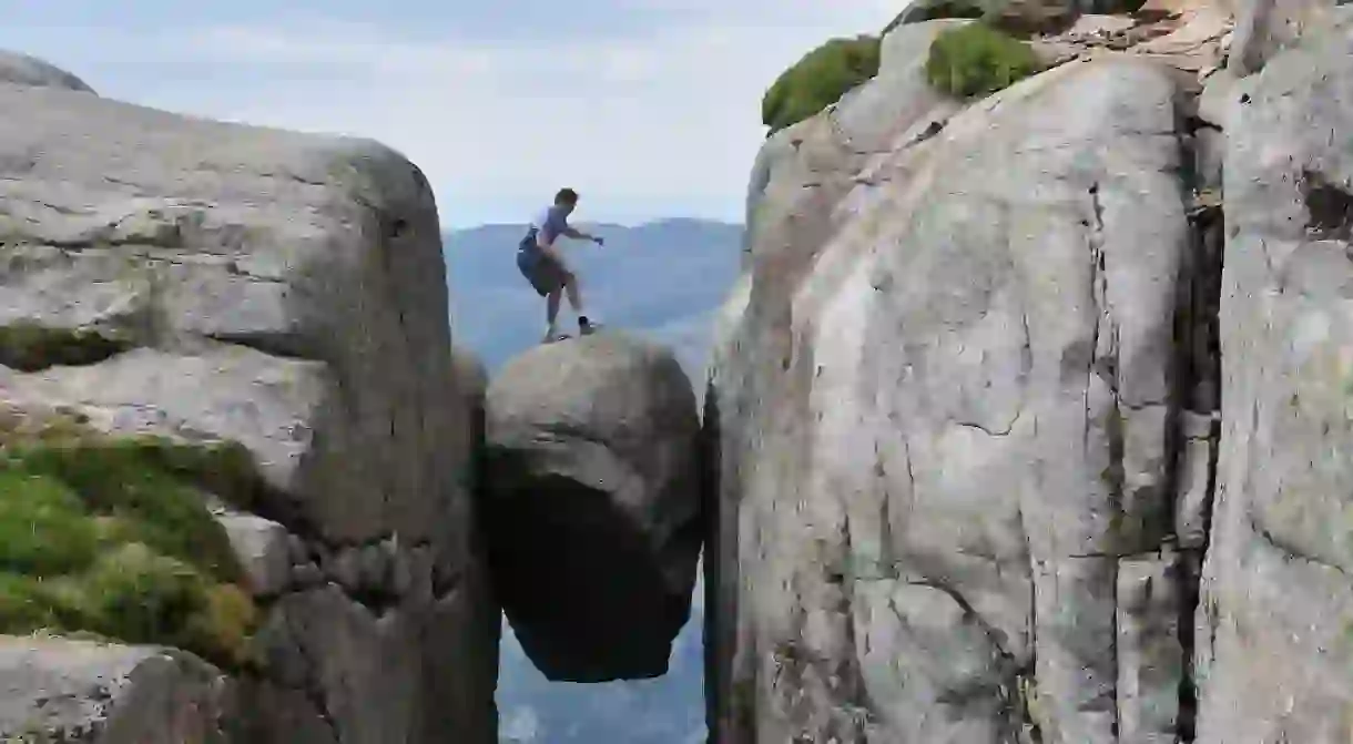
The giant boulder, wedged in the mountain crevasse of Kjerag, is already insta-famous. To get there, you need to follow the trail that starts right next to the Øygardstølen restaurant by the road to Lysebotn – it will take you about six hours and you have to make sure you’re in a peak physical condition before you attempt it. But then again, if it was easy to be insta-famous, everyone would be doing it.

Preikestolen

Romsdalseggen
The hike across the Romsdalseggen ridge takes between five and eight hours, but before you decide that this feels like too much work, you should consider what awaits you there. Spectacular views of the Romsdalsfjellene mountains, the Trollveggen cliff, the town of Molde and even the Norwegian Sea. It’s quite possible that you can even see your house from the top of the ridge.

Trolltunga
We saved the best (or, most obvious) for last. Everyone knows Trolltunga is one of the most famous and scenic cliffs in the country, hovering 700 metres (2296 feet) above the Ringedalsvatnet lake. It’s a challenging 10 to 12 hour hike that starts in Skjeggedal and goes through the high mountains, so you need to be mindful of your limits, as well as the weather (it’s not actually recommended to go there from mid-October to March).


